Our trip last week got off to a rough start. The first day we left Dakar at 6am and our rented car and driver (many rented cars here come with a driver) drove us 3 hours north of Dakar to the colonial era town of St. Louis. We had breakfast there and afterward expected to continue on the long trip to Matam. However, at this point it became clear there was a misunderstanding. The driver had been told we only wanted to go as far as St. Louis. Many calls ensued between the driver and the owner of the car, and after a heated discussion it became apparent we had no choice but to return to Dakar, because the car’s owner did not want us taking the car further into the desert. So we then spent another 3 ½ hours driving all the way back to Dakar, then there was a heated discussion with the owner who did not want to refund any of the money we paid for 5 days of rental, and finally the search for another car. At that point it was too late to begin the long trip again, so we tried again the next day.
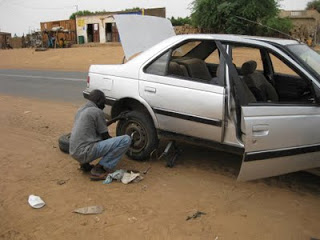 The second attempt was a successful, if hot and dusty, 13 hour trip to Matam in eastern Senegal. On the way we got the first of three flat tires during the trip- the paved road is basically a series of giant pot-holes much of the way, and cars weave between them, coming at each other and missing by inches, driving off the paved road onto the dirt road that borders and continuing at high speed. Every car carries 2 or 3 spare tires. Huge herds of goats, sheep and cows graze everywhere and often stand in the road, we had to nudge the car through them countless times every hour. It was amazing to see how the desert tansformed with the rains; what had been a few scrubby trees in the red sand last January were now lush trees in a sea of grasses, crops of sorghum and melons, with the flood plain of the Senegal River clearly in view (the actual river is normally out of sight from the road).
 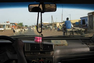 Dashboard view: Koran and prayer beads, dust, small towns, lots of goats and donkey carts!
Once we reached Matam, an air-conditioned room and a cold shower was an absolute slice of heaven. We were also treated to wonderful meals and hospitality by Commandant Seck and his family- he oversees the dams and irrigation for the Matam area and has been extremely interested to help manatees from getting trapped by the dams. He was the person who donated use of a tractor and trailer last January so we could tasnsport the stranded manatees back to the main Senegal River.
For each of the next 3 days we started out at 5am and drove another hour south from Matam to the town of Kanel. Between Matam and Kanel the river had expanded from its channel into an enormous flood plain, approximately 35 km long and 12 km wide. This is only one of many areas along the length of the river that has flooded and covered huge areas with water, flooding trees and allowing catfish and manatees to swim where cows graze in the dry season. For the manatees it becomes a wonderful feeding area, with tall grasses and water lilies stick up through the water. For us it was incredible to see the transformation, but daunting to try to find one tagged manatee in miles of water with only a non-motorized canoe!
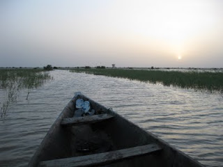
Sunrise at Kanel
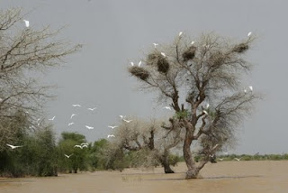
Egrets fly near flooded trees. The blobs at the top of the tree are weaverbird colony nests.
We went out with three guys from Kanel who in previous years helped rescue stranded manatees when the water dried up. They had seen several mating herds the week before and took us to those places, but unfortunately hours of scanning the water in the scorching sun didn’t turn up any manatees. At the same time we listened for the tagged manatee, who was supposed to be in the area, but we didn’t hear the VHF signal. It was still really interesting to see the area though and to realize the importance of the flooding in the manatee’s feeding life cycle.
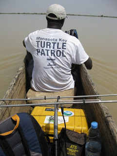 Heading out in a tippy canoe with all our gear, the air still and hot
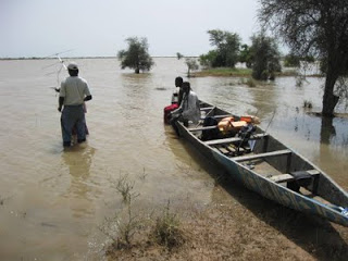 Tomas shows the guys how to use the VHF receiver.
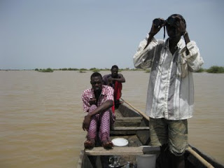 Scanning, scanning, scanning…
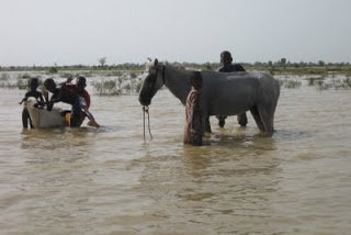 People from the village were swimming and washing their animals in the flooded plain
On the first evening we went to the Navel Dam, the place where were rescued and tagged manatees last January. It was astounding to see the difference in the water levels:
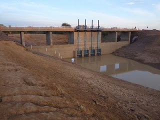
This is the Navel Dam in November 2008 near the height of the dry season (photo courtesy of P. Fernandez de Larrinoa)
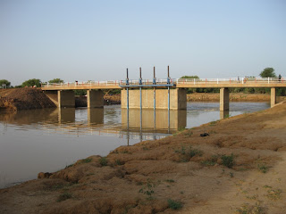
This is the Navel Dam last week, with water level 9 meters higher
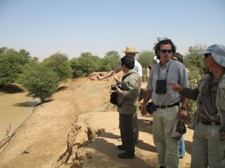
This was the Navel manatee rescue site last January. Note the cliff edge in the foreground.
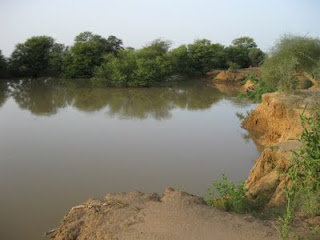
This is a photo taken at the same site last week, with water almost to the top of the cliff.
I brought along the VHF receiver to the dam, because the tagged manatee could be anywhere and the receiver only works at a range of about 3 km. After listening to static for awhile, suddenly we heard the signal! It was incredible luck considering the size of the flooded area. The signal was faint, meaning the manatee was not close by, and came intermittently, meaning she was probably traveling, so the tag was only coming to the surface of the water every few minutes. We listened for 45 minutes before it got dark. It was frustrating not to be able to get closer to see her, but there are no roads along the river’s edge and we didn’t have a boat to search by water.
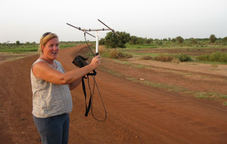
Tomas took this photo just as I heard the signal… surprise and happiness!
We tried listening for the signal the following two evenings at Navel, but we didn’t hear it again. I hoped she was heading south and that maybe we would hear the signal from the Kanel side during our boat surveys, but the area was too huge and our ability to cover it too limited. However, it was still great to hear the tag at all, to know she’s still in the general vicinity of Matam and that the VHF portion of the tag is working.
While in Matam we had nice meetings with many of the people who are interested to help the manatees: Eaux et Forets (Water and Forestry), the Matam and Navel Fisheries Commissioners. After 3 days we started back to Dakar, making a few stops along the way, which I’ll write more about next.
 The second attempt was a successful, if hot and dusty, 13 hour trip to Matam in eastern Senegal. On the way we got the first of three flat tires during the trip- the paved road is basically a series of giant pot-holes much of the way, and cars weave between them, coming at each other and missing by inches, driving off the paved road onto the dirt road that borders and continuing at high speed. Every car carries 2 or 3 spare tires. Huge herds of goats, sheep and cows graze everywhere and often stand in the road, we had to nudge the car through them countless times every hour. It was amazing to see how the desert tansformed with the rains; what had been a few scrubby trees in the red sand last January were now lush trees in a sea of grasses, crops of sorghum and melons, with the flood plain of the Senegal River clearly in view (the actual river is normally out of sight from the road).
  Dashboard view: Koran and prayer beads, dust, small towns, lots of goats and donkey carts!
 Sunrise at Kanel
 Egrets fly near flooded trees. The blobs at the top of the tree are weaverbird colony nests.
  Heading out in a tippy canoe with all our gear, the air still and hot
![]() Tomas shows the guys how to use the VHF receiver.
Tomas shows the guys how to use the VHF receiver. Scanning, scanning, scanning…
 People from the village were swimming and washing their animals in the flooded plain
  This is the Navel Dam in November 2008 near the height of the dry season (photo courtesy of P. Fernandez de Larrinoa)
 This is the Navel Dam last week, with water level 9 meters higher
 This is a photo taken at the same site last week, with water almost to the top of the cliff.
